yahoo Press
Why the Spokane wildfires exploded so fast: drought, heat and a rare fire warning
Images
1 / 13

2 / 13

3 / 13
4 / 13
5 / 13
6 / 13
7 / 13
8 / 13
9 / 13
10 / 13
11 / 13

12 / 13

13 / 13
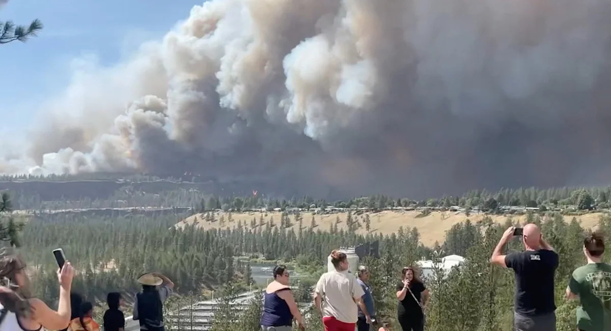
Around 60,000 people have been ordered to evacuate as wildfires threaten the city of Spokane, Wash., where three separate blazes have destroyed hundreds of homes and businesses.

Fast-moving wildfires tore across the Spokane area over the weekend, forcing thousands of people to flee and prompting a statewide emergency. Spokane Mayor Lisa Brown has called it "the worst natural disaster our region has faced."

Fires in and around Spokane burned about 8.2 square miles, totaling 5,390 acres (2,180 hectares) by Sunday, Spokane's fire chief Tom Williams told Reuters.

A total of about 390 square miles (1,000 square kilometers) has burned across the state, and some of the fires, including those in the Spokane area, have not been contained.

More than 7,700 homes are without power, according to the latest data from utility company Avista.

Fire and law enforcement officials said there had been no reports of injuries or people unaccounted for, but they stressed it was early in the response effort.

U.S. Sen. Maria Cantwell has warned that the area is "not out of danger." During a news conference with federal, state and local officials in Spokane, the Washington lawmaker added that "the next couple of days will be challenging."

Several fires broke out Saturday afternoon in and around Spokane. Investigators have yet to determine how the blazes started.

The largest, the Old Trails Fire in northwest Spokane, had burned about 3,500 acres by Sunday morning, with other fires burning nearby.

Preliminary assessments estimate that about 600 structures have been destroyed, according to Tom Stokesberry, a spokesperson for a California incident management team helping in Spokane. He cautioned that the figure includes outbuildings and that it was not yet clear how many were homes.

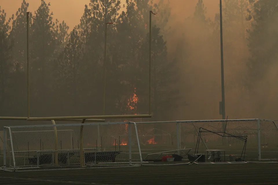
Old Trails Fire burns near Dwight Merkel Sports Complex, Saturday, Aug. 1, 2026, in Spokane, Wash. (AP Photo/Young Kwak)

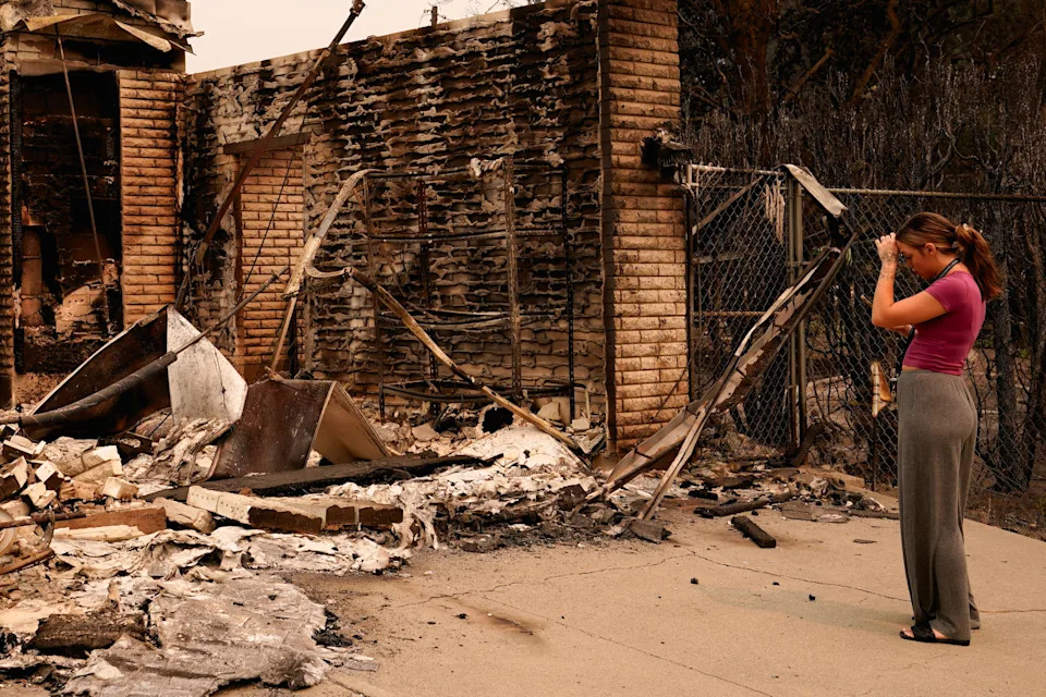
Ash Sollie looks at her grandparents' house, where she previously lived, after it was destroyed by a wildfire.

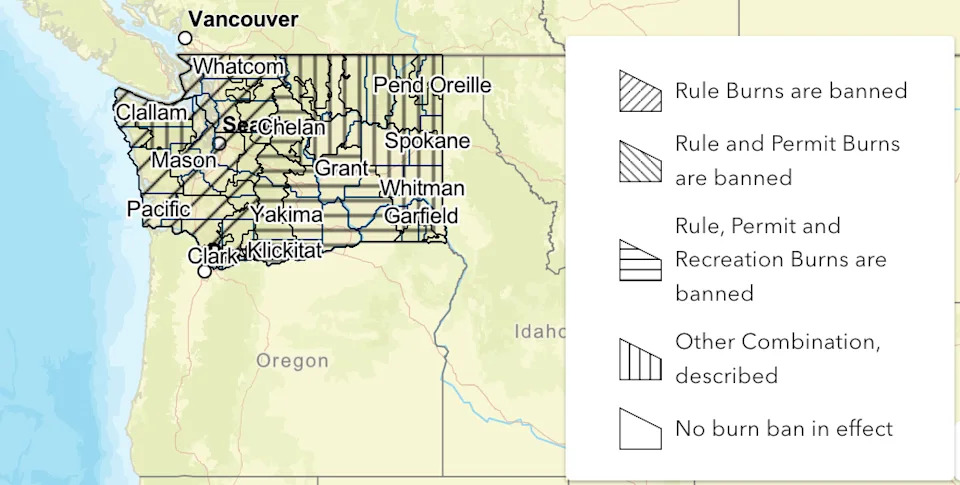
According to the Washington State Department of Natural Resources (DNR) burn ban map, fire restrictions are in effect across much of Washington state.

According to the Washington State Department of Natural Resources (DNR) burn ban map, fire restrictions are in effect across much of Washington state.

Burn bans cover most counties in western and central Washington and extend into several counties in the east, indicating that restrictions have been implemented across a broad geographic area.

Know before you go outside. The new Yahoo Weather app tracks real-time heat and "feels like" temps for your area.

Forecasters had warned for days that conditions were primed for disaster. The National Weather Service issued a "Particularly Dangerous Situation" fire-weather warning for central and eastern Washington, a rare step reserved for the most extreme conditions. The Spokesman-Review reported it was the first such warning ever issued for eastern Washington.

The trigger was a combination of extreme heat, low humidity and wind gusts of 35 to 45 mph, on top of Washington's fourth straight year of statewide drought. When the Old Trails Fire started near Airway Heights around noon Saturday, the wind drove it into Riverside State Park and then across the Spokane River into city neighborhoods within hours.

Authorities in Spokane have issued evacuation orders, emptying much of the city's northwest.

A shelter at Spokane's main convention center was housing about 400 people who were staying there as of Sunday, officials told Associated Press.

The Mann-Grandstaff VA Medical Center evacuated patients, and the city cleared its water reclamation facility and waste-to-energy plant.

Spokane County Commissioner Chris Jordan said relatives of his were in an area affected by the fires and they don't know if their home is still standing. He said he spoke with them as they were leaving the home.

"They're in their car and all they can see is smoke everywhere, and it was incredibly scary for so many people," he said during the news conference.

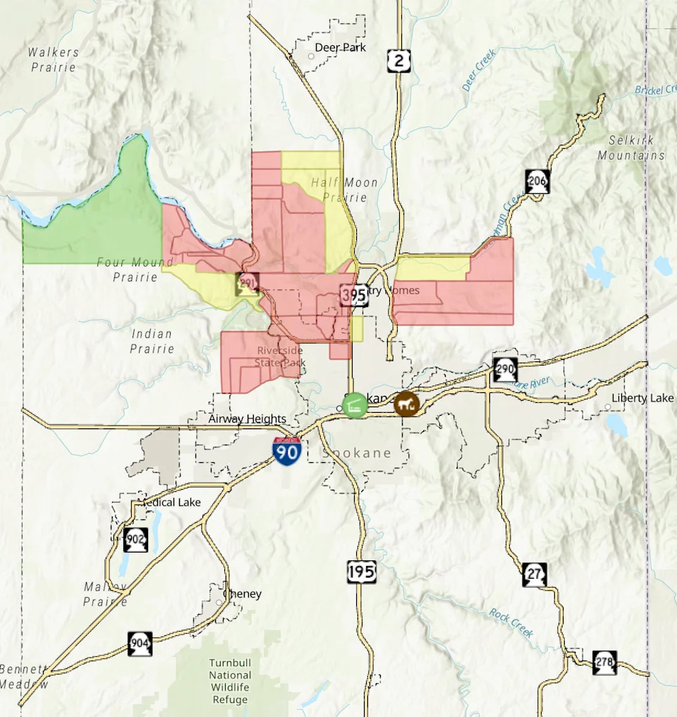
Level 3 "go now" evacuation orders are currently centered around Riverside State Park, extending through Indian Prairie and along the U.S. Highway 395 corridor.

Level 2 "Be Set" evacuation orders form a buffer surrounding the highest-risk Level 3 areas. They are concentrated around Half Moon Prairie, extending along sections of the U.S. Highway 395 corridor north of Spokane.

A map of the areas of Spokane under evacuation orders. Red indicates 'go now', yellow indicates 'get set', and green indicates 'be ready'.

The Spokane fires are part of a brutal season statewide. Officials said more than 1,000 fires have burned about 425,000 acres in Washington this year, the most since 2021, with a dozen large fires still active. "This year has already been one of our busiest wildfire years on record, and we just started August," Public Lands Commissioner Dave Upthegrove said.

Old Trails Fire is seen from W. Northwest Blvd., Saturday, Aug. 1, 2026, in Spokane, Wash.

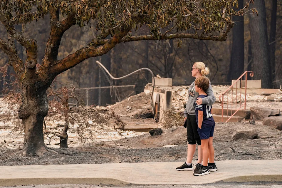
Jana Jensen surveys the neighborhood where her childhood home, owned by her parents, was lost to wildfire, while embracing her son, Aaren, 8.

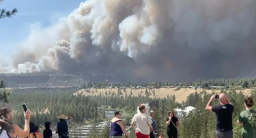
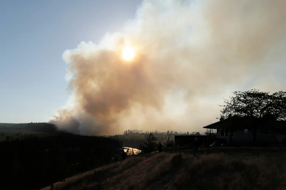
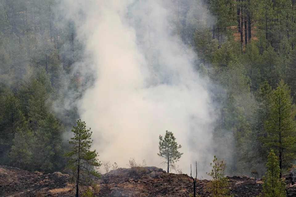
Smoke billows from the Old Trails Fire as wildfires burn in Spokane, Washington.

Several officials expressed concern that the area does not appear likely to get a break in the coming days from the weather, which is expected to remain dry.

The National Weather Service forecast for Monday indicates warm and dry conditions in Spokane, with a high of approximately 27°C (80°F). Hazy skies are expected due to smoke from ongoing wildfires, resulting in poor air quality, while the absence of precipitation and continued dry conditions are expected to contribute to ongoing wildfire concerns.

Gov. Bob Ferguson, who has declared a statewide emergency and implemented a burn ban, said he had spoken with President Trump on Sunday and requested assistance from the Federal Emergency Management Agency.
Comments
You must be logged in to comment.