yahoo Press
The US is seeing stronger storms, so why are droughts getting worse?
Images
1 / 8
2 / 8

3 / 8

4 / 8
5 / 8
6 / 8

7 / 8

8 / 8
About two-thirds of the U.S. is in some stage of drought in late spring 2026, yet at the same time the country has been seeing more intense downpours. It might seem contradictory, but both are symptoms of rising global temperatures.

The reason has to do with the water cycle.

Water influences every aspect of our lives through a delicate cycle that transforms liquid water into vapor and back again.

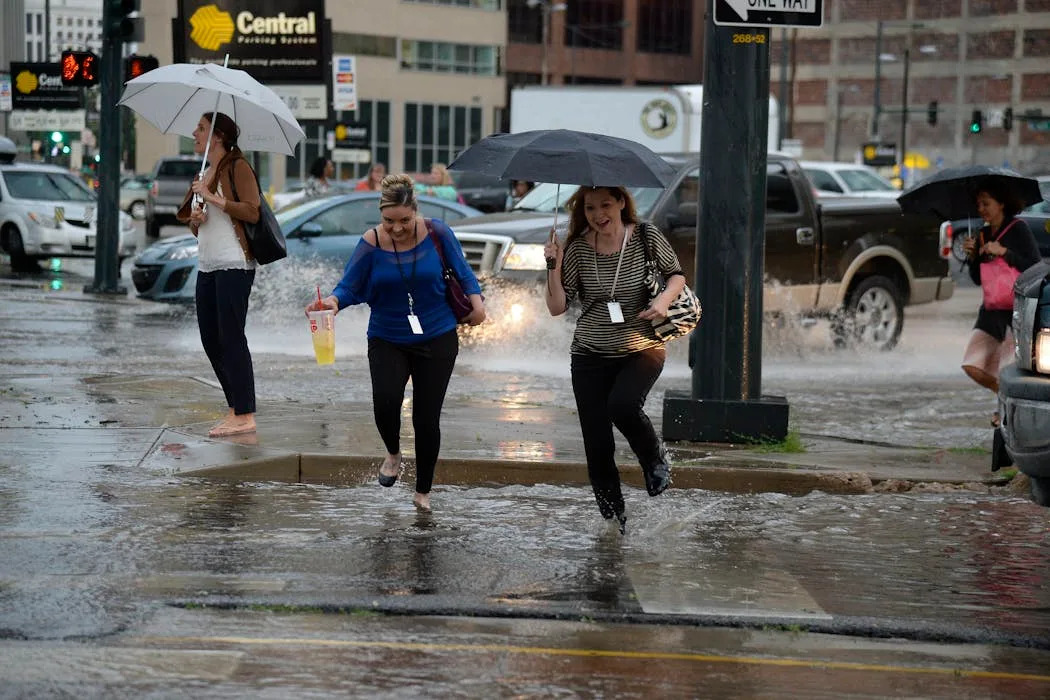
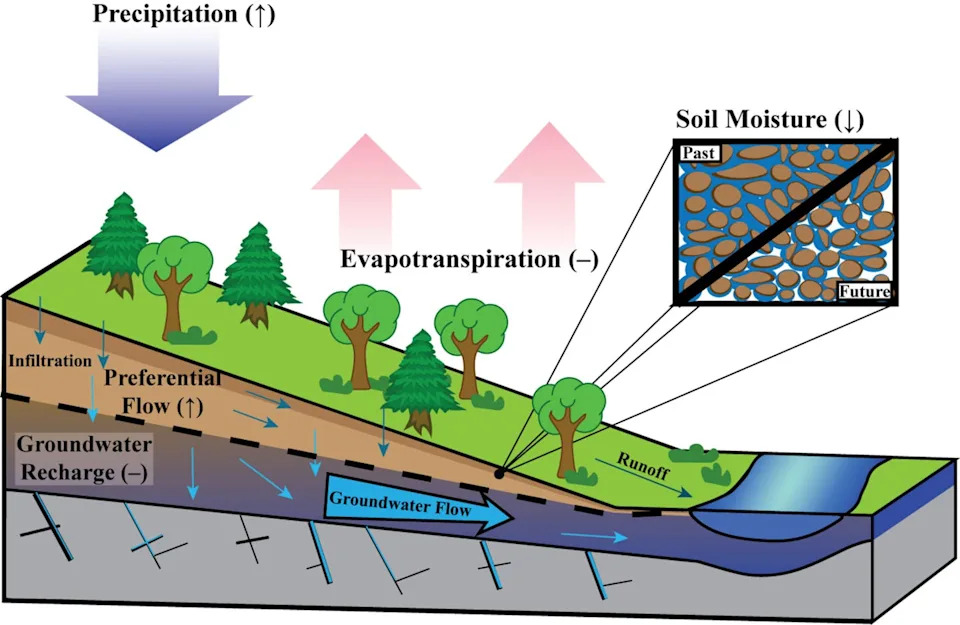
As the Earth warms, more of that precipitation is arriving in intense storms that deliver more water than the landscape can handle. When storms drop a few inches of rain over a few days, the water sinks into the soil, nourishing plants and replenishing groundwater. But during heavy downpours, the rain can’t sink in fast enough, and much of the water runs off instead, often fueling flooding.

Water also evaporates faster in warmer temperatures. So, despite an increase in total annual precipitation nationally, the landscape is drying out more rapidly as temperatures rise, resulting in more severe and frequent droughts.

I’m a hydrologist at UMass Amherst. My colleagues and I are documenting these broad shifts and what they mean for the future of the terrestrial hydrological cycle – the water cycle on land – and the people and ecosystems that depend on it. The effects are occurring across climates around the world.

Fundamentally, the terrestrial hydrological cycle is controlled by two things: precipitation that adds moisture to the ground and evapotranspiration, meaning water that evaporates either from the land back into the atmosphere or from plants releasing it through their leaves.

Over the long term, the total amount of precipitation that falls, minus the total evapotranspiration sending moisture back into the atmosphere, determines how much water moves through the hydrologic system. That affects stream flow, soil moisture and the amount of water sinking into the ground and recharging aquifers.

When this balance shifts or becomes out of sync with its natural state, it affects how water moves through the landscape. And that directly influences where water is available and how much is there.

These shifts in precipitation are occurring alongside longer growing seasons that allow the land to accumulate more heat. As temperatures rise, drier air also pulls more water from the landscape, increasing the risk of drought.

The changing timing of precipitation can result in counterintuitive feedbacks, as recent studies in the Northeast have shown.

In one study, scientists at Harvard Forest found that more intense storms are delivering greater amounts of water at rates exceeding the soil’s capacity to retain it. For example, in 2023 they found that high-intensity events in their research area made up about 42% of the year’s total precipitation.

When more precipitation is concentrated, with long gaps between storms, the surface soils have time to drain and dry out. This has contributed to drier atmospheric conditions as less water is available to evaporate from the land.

This effect from bursts of heavy rain with dry periods in between shows up in data. My research group at UMass found in a separate study that while wet years in the Northeast are becoming more frequent, dry years are also becoming more frequent.

During the wettest years over the past decade, we found an accumulation of approximately 2 inches of water in the shallow ground, contributing to higher water tables, more frequent flooding and damage to infrastructure during heavy rainstorms.

Conversely, during dry periods the landscape dries out rapidly, resulting in drought advisories, fires, water restrictions and crop failures in what is normally one of the wetter regions of the U.S.

Many states are now incorporating climate science into decisions about infrastructure and land use to better understand the risks ahead. Massachusetts, for example, created a climate data clearinghouse to make research and data widely available. It also invested in computer models to examine potential future scenarios of water storage on the landscape so communities and farmers can prepare.

Communities can boost their resilience to extreme storms with urban designs and construction that take flood risk into account, include careful drainage as more areas are paved and add features such as rain gardens, riverside parks and bioswales that move and hold more water where needed.

To manage dry years, communities can implement conservation measures, such as limiting outdoor watering, subsidizing low-flow toilets and showers, and using water pricing to encourage more careful use. They can also teach residents how to use less water and generally be more mindful of water use.

On a larger scale, a new study using computer models indicates that more aggressive efforts to reduce the drivers of climate change – particularly reducing greenhouse gas emissions from burning fossil fuels – can reverse the trend of extreme precipitation, eventually returning to rates seen in the 20th century.

Until that happens, however, the world will have to adapt to a changing hydrological cycle.

This article is republished from The Conversation, a nonprofit, independent news organization bringing you facts and trustworthy analysis to help you make sense of our complex world. It was written by: David Boutt, UMass Amherst

Read more:

Water conservation works, but climate change is outpacing it: Phoenix, Denver and Las Vegas offer a glimpse of the future

Farmers face a soaring risk of flash droughts in every major food‑growing region in coming decades, new research shows

The water cycle is intensifying as the climate warms, IPCC report warns – that means more intense storms and flooding

David Boutt receives funding from the United States Geological Survey
Comments
You must be logged in to comment.