yahoo Press
Isaias came ashore Friday night as a Category 2 hurricane and is now a post-tropical storm. Heavy rain and flash flooding remain a threat across the Southeast through the weekend.
Images
1 / 20

2 / 20

3 / 20
4 / 20

5 / 20

6 / 20
7 / 20
8 / 20
9 / 20
10 / 20
11 / 20
12 / 20

13 / 20
14 / 20
15 / 20

16 / 20

17 / 20
18 / 20
19 / 20

20 / 20
Isaias made landfall near Destin, Fla., around 9:30 p.m. ET Friday as a Category 2 hurricane with maximum sustained winds of 105 mph, the National Hurricane Center said. It was the first hurricane of an unusually quiet Atlantic season. At least two people were killed by falling trees, one in Florida's Escambia County and one in the Birmingham, Ala., area, officials said.

The storm weakened quickly as it moved inland. As of 5 a.m. ET Saturday, it was a post-tropical storm with 35 mph winds about 25 miles south-southwest of Montgomery, Ala., moving north at 14 mph. It is expected to cross Alabama into the Tennessee Valley and dissipate Sunday.

More than 900,000 homes and businesses in Florida, Alabama and Georgia were without power Saturday morning, according to PowerOutage.us. Downed trees and power lines blocked roads in Pensacola and Mobile, and roads flooded in Destin.

The biggest threat now is rain. The NHC expects 4 to 8 inches across southern Alabama, the Florida Panhandle and southwest Georgia through the weekend, with up to 15 inches in spots. Flash flooding and landslides are possible in the southern Appalachians.

Is the storm headed your way? Follow it in real time on the new Yahoo Weather app.

Follow live updates on Isaias below.

Keon Sabb #3 of the Alabama Crimson Tide looks on during the game against the Mississippi State Bulldogs at Davis Wade Stadium on October 03, 2026 in Starkville, Mississippi. (Photo by Justin Ford/Getty Images)

Isaias forced changes to at least seven college football games this weekend across the Gulf Coast and the Carolinas, according to CBS Sports and FBSchedules.

West Florida canceled its home game against Northeastern State in Pensacola, citing safety concerns for its campus and community. The school does not expect to reschedule it.

Other games were moved:

Florida A&M at Alabama State moved from Saturday to Friday in Montgomery, Ala. Alabama State also rescheduled its homecoming events.

Rice at East Carolina moved up three hours to 1 p.m. ET Saturday.

Davidson at Presbyterian, East Tennessee State at The Citadel and South Carolina State at Charleston Southern all moved to noon ET Saturday.

Southern at Prairie View A&M moved to 4 p.m. ET Saturday.

The biggest game of the day, No. 2 Georgia at No. 6 Alabama, is still scheduled for 7:30 p.m. ET in Tuscaloosa on ABC. Alabama kept campus parking and tailgating closed until 1 p.m. ET and canceled pregame events on the Quad, and ESPN moved its "College GameDay" broadcast indoors to Coleman Coliseum, the Big Lead reported.

President Trump, who had planned to attend, canceled his trip Friday, saying he didn't want to distract first responders.

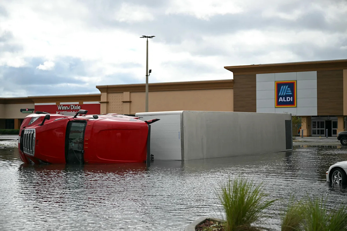
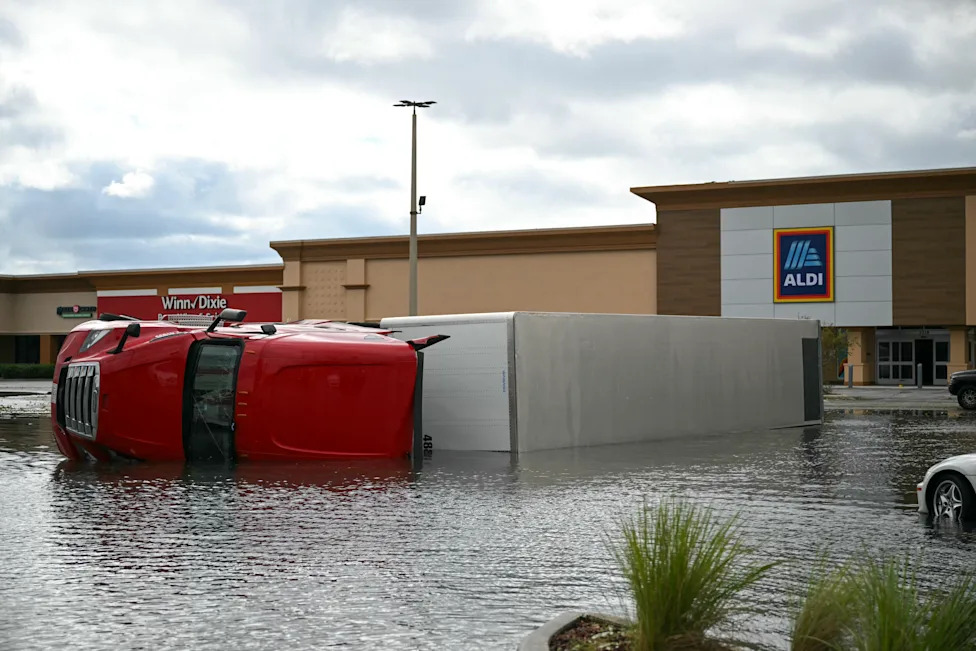
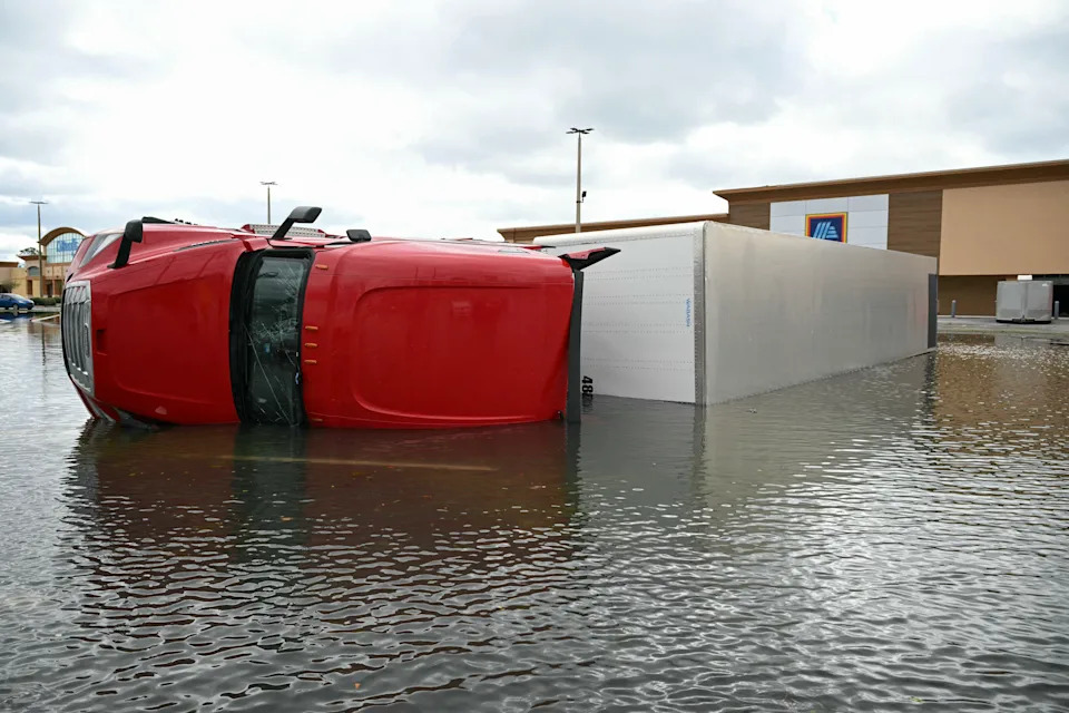
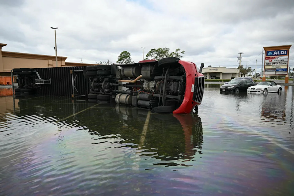
An overturned truck sits in a flooded parking lot in Tiger Point, Fla., on Saturday. (Ronaldo Schemidt/AFP via Getty Images)

Daylight on Saturday showed some of the damage Isaias left in south Santa Rosa County, where Tiger Point sits between Pensacola and Navarre along Santa Rosa Sound.

The area took some of the storm's strongest winds Friday night. A gust of 117 mph was recorded near Oriole Beach, next to Tiger Point, and a 95 mph gust was measured in Gulf Breeze, according to preliminary National Weather Service reports.

Santa Rosa County's 911 center fielded calls overnight about homes hit by trees, roofs torn off and some collapsed homes, but conditions were too dangerous to send responders until the winds died down, an emergency management official told the Navarre Press. Crews began clearing roads early Saturday with help from six National Guard units.

The American Red Cross has sent more than 140 volunteers to the Gulf Coast, including a 12-person team from Birmingham, Ala., WALA reported. Teams are working from a warehouse in Mobile and moving trailers of supplies to hard-hit communities. Two shelters that opened before the storm remain open and could become longer-term emergency housing if needed.

People who want to volunteer or donate can sign up at RedCross.org.

For residents returning home, the National Weather Service warned that Isaias "left plenty of hazards behind," including downed trees and power lines, swollen streams and standing water, according to the Northwest Florida Daily News. "Use caution as you emerge today from your safe place," the agency said. "Only use generators outdoors."

If your home was damaged, insurance experts recommend these steps before you start cleaning up:

Take photos and video of all damage, inside and out, including roofs, fences, cars and standing water.

Make a list of damaged items, and don't throw anything away until an adjuster has seen it.

Keep receipts for emergency repairs, like tarping a roof, and photograph the work.

Contact your insurance company as soon as possible.

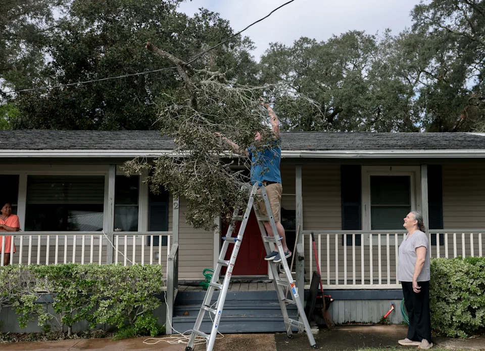
Jerry Henton tries to remove a tree branch from the power line to his home after it fell when Hurricane Isaias passed through the area on October 10, 2026, in Fort Walton Beach, Florida. (Photo by Joe Raedle/Getty Images)

Florida reopened all state-owned bridges, along with Interstate 10 and U.S. 98, early Saturday after crews worked overnight to clear debris and inspect roads, Gov. Ron DeSantis said at a morning news conference. Smaller roads were still blocked in some areas, CBS12 reported.

As of DeSantis' briefing, the state had received no requests for search and rescue, according to the Pensacola News Journal. Thousands of utility workers were sent to the hardest-hit communities, where about 448,000 Florida customers were without power at 8 a.m. ET.

In Santa Rosa County, crews found that storm surge had not breached the protective sand berm on the east end of Navarre Beach, County Administrator Brad Baker told the Navarre Press. An emergency management official there credited residents who followed evacuation orders for the low number of surge-related 911 calls.

In Alabama, more than 5,000 additional utility crews from nearly 25 states were heading in to help restore power, according to Alabama Power.

The city of Pensacola still urged people to stay off the roads where possible. Many intersections were blocked by downed lines and trees.

At least two people were killed by falling trees as Isaias moved inland Friday night, according to officials in Florida and Alabama.

In Florida's Escambia County, which includes Pensacola, a woman was killed when a large tree fell onto a home on Flagler Drive, the sheriff's office said. Fire rescue crews found her pinned beneath the tree at about 9:48 p.m. ET.

"Our thoughts and prayers are obviously with that family," Escambia County Sheriff Chip Simmons said, according to nola.com.

In Alabama, the Jefferson County Emergency Management Agency, which covers Birmingham, said a second person was killed by a fallen tree. Officials have not released either victim's name.

Isaias' strongest winds hit the western Florida Panhandle Friday evening, according to preliminary reports from the National Weather Service in Mobile, Ala. The highest gusts included:

117 mph near Oriole Beach, Fla.

116 mph on Santa Rosa Sound

114 mph in Milton, Fla.

105 mph near Navarre, Fla.

102 mph at Pensacola City Hall

The storm also dumped heavy rain. Shalimar, Fla., recorded 9.65 inches in 24 hours, and a gauge north of Valparaiso, Fla., recorded 9.6 inches. Destin got about 7.5 inches, the weather service said.

The rain fell on ground that was already soaked. Parts of the Panhandle got 10 to 14 inches of rain in early October, before Isaias arrived, according to the weather service. That raises the risk of flooding as more rain falls through the weekend.

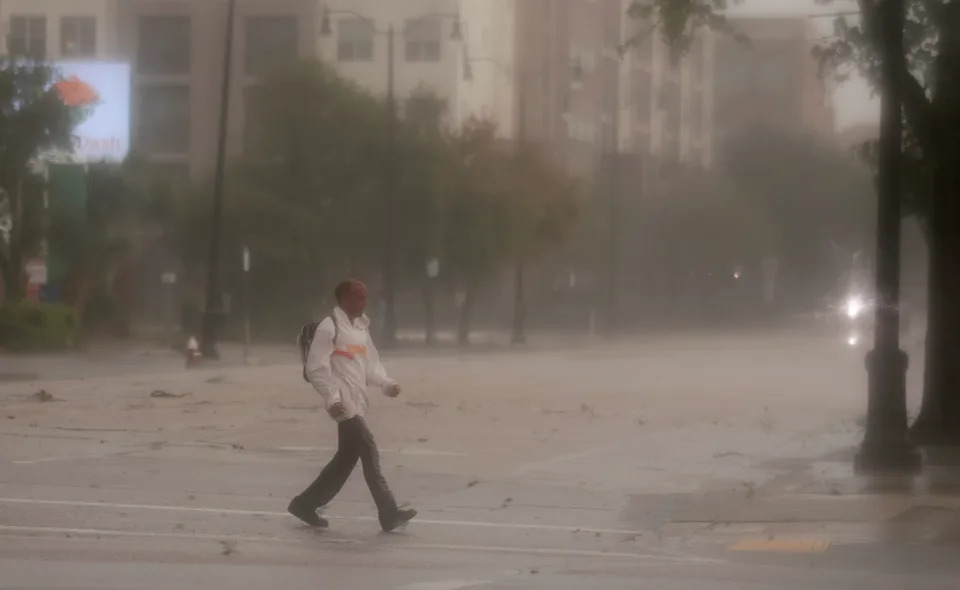
A person walks through the wind and rain as Hurricane Isaias passes through the area on October 09, 2026, in Pensacola, Florida. Hurricane Isaias is in the Gulf of Mexico as the season's first Atlantic hurricane. (Photo by Joe Raedle/Getty Images)

The full extent of the damage wasn't clear Saturday morning, but residents posted photos of downed trees and power lines across the Panhandle, the Associated Press reported. Video showed strong winds tearing the roof off a hotel in Pensacola.

Pensacola police told residents to stay off debris-covered roads, and streets in Destin flooded. Some Panhandle counties temporarily suspended emergency response Friday night because conditions were too dangerous. In Alabama, Mobile officials reported downed trees and power lines, and roads were closed in Houston County.

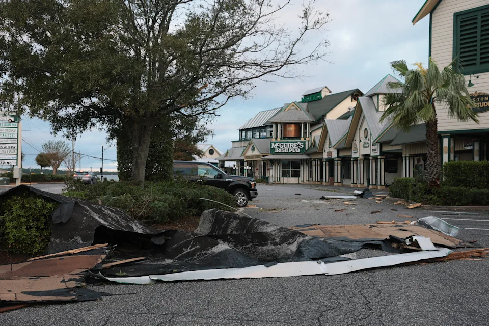
Roofing material lies on the ground after Hurricane Isaias tore it off as it passed through the area on October 10, 2026, in Destin, Florida. (Photo by Joe Raedle/Getty Images)

Isaias came ashore near Destin, Fla., around 9:30 p.m. ET Friday with maximum sustained winds of 105 mph, making it a Category 2 hurricane, according to the NHC. It had peaked earlier Friday as a Category 3, with 120 mph winds.

Weather stations recorded a 116 mph gust near Santa Rosa Sound and a 100 mph gust near Pensacola. A NOAA gauge in Panama City Beach measured water 5.6 feet above the normal high-tide line.

About 884,000 homes and businesses were without power Saturday morning, according to PowerOutage.us:

Florida: about 430,000

Alabama: about 325,000

Georgia: about 129,000

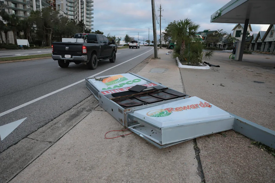
A gas station sign lies on the ground after Hurricane Isaias knocked it over as it passed through the area on October 10, 2026, in Destin, Florida. (Photo by Joe Raedle/Getty Images)

Isaias is no longer a hurricane or a tropical storm. As of 5 a.m. ET Saturday, the National Hurricane Center said:

It was about 25 miles south-southwest of Montgomery, Ala., and 105 miles south of Birmingham.

Its maximum sustained winds had dropped to 35 mph.

It was moving north at 14 mph.

All coastal watches and warnings have been lifted. Isaias is expected to turn north-northeast Sunday and dissipate over the Tennessee Valley. Forecasters said flash flooding remains the main danger, with "considerable impacts likely" across southern Alabama, the Florida Panhandle and southwest Georgia.

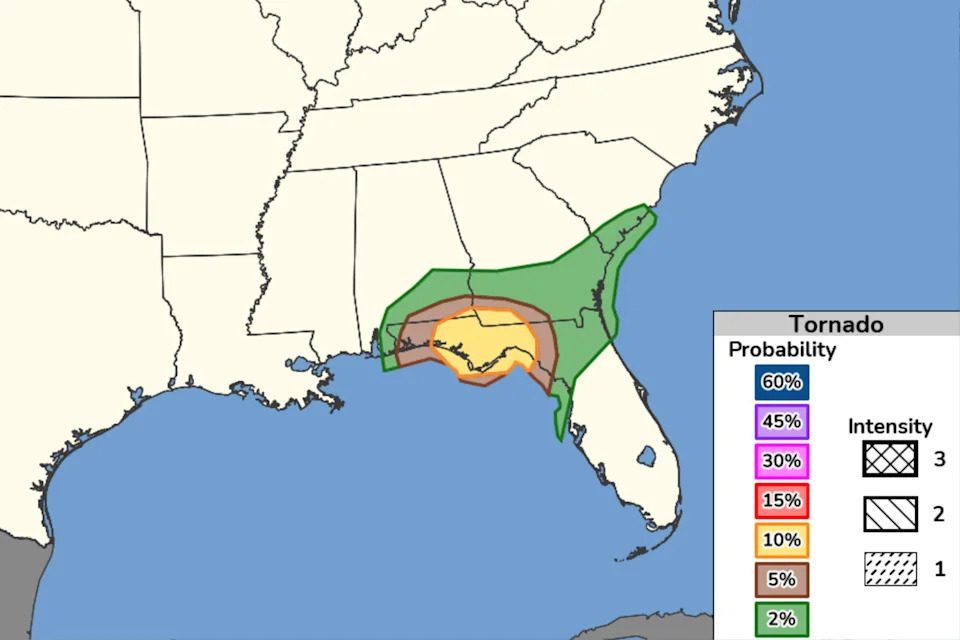
Areas experiencing increased tornado risks on Friday caused by Hurricane Isaias

The National Weather Service warned Friday that strong winds from Hurricane Isaias are increasing the risk of tornadoes in areas impacted by the storm.

"The greatest risk will be east of the center, particularly across the Florida Panhandle into southern Georgia," the NWS wrote in a public advisory Friday afternoon.

Forecasters expect tornado risk to continue into Saturday as the storm makes its way inland, spreading to new areas across Georgia and into the Carolinas.

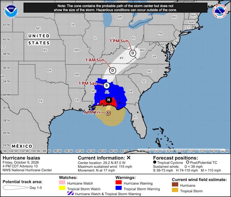
According to the most recent advisory from the National Hurricane Center, as of 5 p.m. ET on Friday:

Hurricane Isaias was about 90 miles south of Pensacola, Fla., and roughly 125 miles south-southeast of Mobile, Ala.

The storm had maximum sustained winds of 115 mph

It was moving north-northeast at 17 mph

Isaias is expected to make landfall in the western Florida Panhandle later tonight.

"Little change in strength is expected before Isaias makes landfall this evening," the NHC said. "Weakening is expected to begin tonight after landfall, and Isaias is forecast to become post-tropical on Saturday."

President Trump is shown on the jumbotron before a college football game between Texas and Tennessee at Neyland Stadium in Knoxville on Sept. 26.

President Trump announced Friday that he will not be attending Alabama's pivotal college football matchup against Georgia in Tuscaloosa, Ala., on Saturday because of Hurricane Isaias.

"It is important to have our wonderful First Responders, Law Enforcement, and others, focused on that Storm, and in no way be thinking about the safety, or presence, of the President of the United States, ME!" Trump wrote on Truth Social.

Earlier in the week, Trump had told reporters that he still intended to travel to the game, despite the impending storm.

"I love Alabama. I got to go to a game like that," he told reporters on Wednesday, but added that he would consider changing his plans "if there's an emergency."

There had been some speculation that the game might be postponed or relocated because of Isaias, but organizers have said it will be played as scheduled.

According to the most recent forecasts, Isaias will likely be downgraded to a tropical storm by the time it reaches Tuscaloosa on Saturday. The heart of the storm is expected to have moved north of the city by the time the game is scheduled to kick off at 7:30 p.m. ET.

Instead of traveling to Alabama, Trump said he will hold a rally in Tennessee on Saturday in support of Republican candidates for House, Senate and governor in the state.

Florida Attorney General James Uthmeier announced on Friday that the state had opened a hotline where residents can report "unconscionable increases in prices" by retailers in the hurricane's path.

"Protecting Floridians isn't a seasonal job," Uthmeier said in a press release. "Whether it's a storm, a scam, or a greedy corporation, our office will enforce the law."

Florida law prohibits price hikes on "essential commodities and services" that may be needed to prepare for or recover from a major storm, including food, water, ice, gasoline, lumber, equipment and hotel rooms.

Violators can be fined $1,000 for a first offense, with penalties increasing to $25,000 and potential criminal sanctions for severe offenders. Floridians can report suspected price gouging through MyFloridaLegal.com or by calling 1-866-9-NO-SCAM.

With Hurricane Isaias expected to make landfall on the northern Gulf Coast near the Alabama-Florida line, coastal Mississippians may be thinking they caught a break. But the state's governor doesn't want residents to let their guard down.

"We are still expected to receive some effects from the hurricane including 3-5' of storm surge in and around Biloxi through Jackson County and a strong risk of flash flooding throughout the eastern part of our state," Mississippi Gov. Tate Reeves wrote in a post on X. "Continue to stay vigilant and weather aware, Mississippi!"

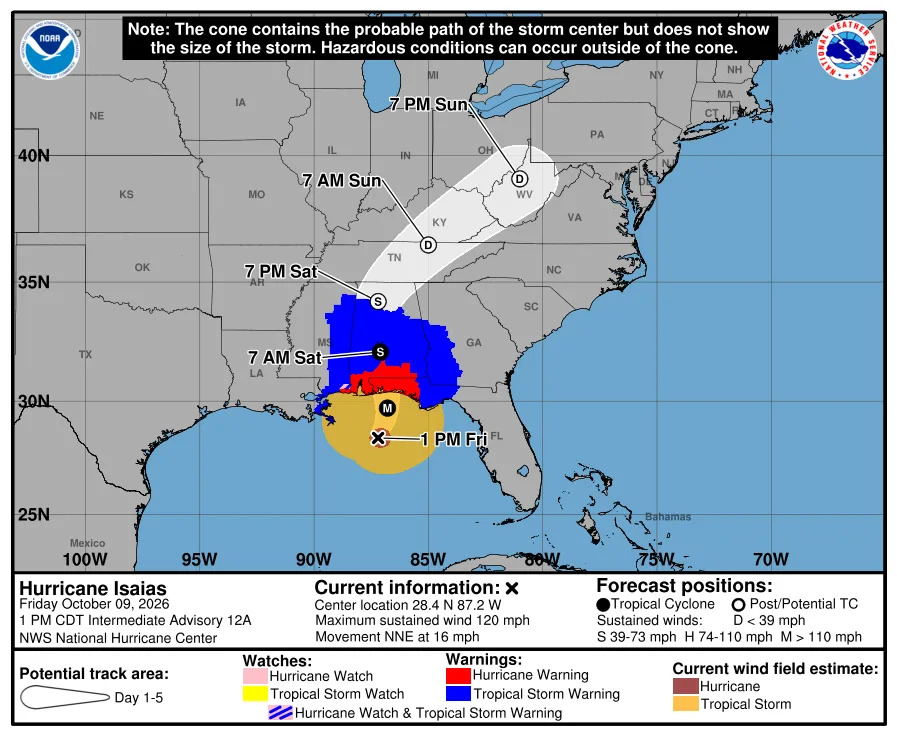
According to the most recent advisory from the National Hurricane Center, as of 2 p.m. ET:

Hurricane Isaias was about 145 miles south of Pensacola, Fla., and roughly 125 miles southeast of the mouth of the Mississippi River

It had maximum sustained winds of 120 mph

It was moving north-northeast at 16 mph

Isaias is expected to approach the northern Gulf Coast this afternoon and make landfall somewhere near the Alabama-Florida line tonight.

"Fluctuations in intensity are possible through this afternoon, but Isaias is expected to be at or near major hurricane strength when it makes landfall this evening," the hurricane center said. "Weakening is expected beginning tonight after Isaias makes landfall, and the storm is likely to become post-tropical by late Saturday."

Want to know how to pronounce Isaias? Don't ask Florida Gov. Ron DeSantis.

While delivering an update on preparations for Hurricane Isaiah, DeSantis said didn't know how to correctly pronounce the storm's name — and wasn't about to try.

"I don't know how to pronounce this because it's not normal," DeSantis said. "So, you know, I'm calling it Isaiah. You guys can call it what you want. I know that's not how you pronounce this. It's something else. But it's weird and I'm just going to keep butchering it for the next 72 hours."

For the record: Isaias, the Spanish form of Isaiah, is pronounced "ee-sah-EE-ahs."

In a livestream update from the National Hurricane Center in Miami, NHC Director Michael Brennan said tropical storm-force winds from Hurricane Isaias will begin reaching the Florida Panhandle within the next few hours.

"So if you are in these evacuation zones and you've been asked to leave by your local officials, please get out as soon as you can before conditions deteriorate," Brennan said.

A storm surge of up to 9 feet is likely, and rainfall totals of up to 15 inches are possible in the western Florida Panhandle, southwestern Georgia and southern Alabama.

He also urged those in the storm's path to use extra caution after it passes.

"Be careful with chainsaws," Brennan said. "Don't push yourself if you're out there in dangerous conditions. Please take care of yourself. And make sure if you're operating a generator, do it well away from your home and vent it away from your home to avoid carbon monoxide poisoning. So please stay safe."

Hurricane Isaias was the first to form in this year's Atlantic season, which begins in June and runs through November. It was one day shy of tying a 121-year-old record for the basin's latest-forming hurricane, according to the Associated Press. That record dates back to 1905, when the season's first Atlantic hurricane formed on Oct. 8.

The season has been unusually quiet this year because of a strong El Niño, which disrupts storm formation over the Atlantic. However, storm activity has been above average in the Pacific,

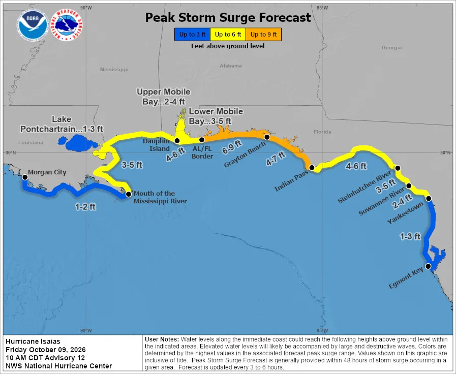
A "life-threatening" storm surge is expected from the mouth of the Mississippi River to Suwannee, Fla., the National Hurricane Center said in its latest advisory. Up to 9 feet of storm surge is possible in some areas.

According to the hurricane center's forecast, the water could reach the following heights above ground somewhere in the following areas:

Alabama-Florida border to Grayton Beach, Fla.: 6-9 ft

Grayton Beach, Fla. to Indian Pass, Fla.: 4-7 ft

Indian Pass, Fla., to Steinhatchee River, Fla.: 4-6 ft

Dauphin Island, Ala., to the Alabama-Florida border: 4-6 ft

Steinhatchee River, Fla. to Suwannee River, Fla.: 3-5 ft

Mouth of the Mississippi River, to Dauphin Island, Ala: 3-5 ft

Lower Mobile Bay, Ala: 3-5 ft

Upper Mobile Bay, Ala.: 2-4 ftSuwannee River, Fla., to Yankeetown, Fla: 2-4 ft

Yankeetown, Fla., to Egmont Key, Fla.: 1-3 ft

Lake Pontchartrain, La.: 1-3 ft

Morgan City, La to the mouth of the Mississippi River: 1-2 ft
Comments
You must be logged in to comment.