yahoo Press
Isaias tracker: First Atlantic hurricane of the season to strengthen before hitting U.S. Gulf Coast
Images
1 / 6

2 / 6

3 / 6
4 / 6

5 / 6

6 / 6
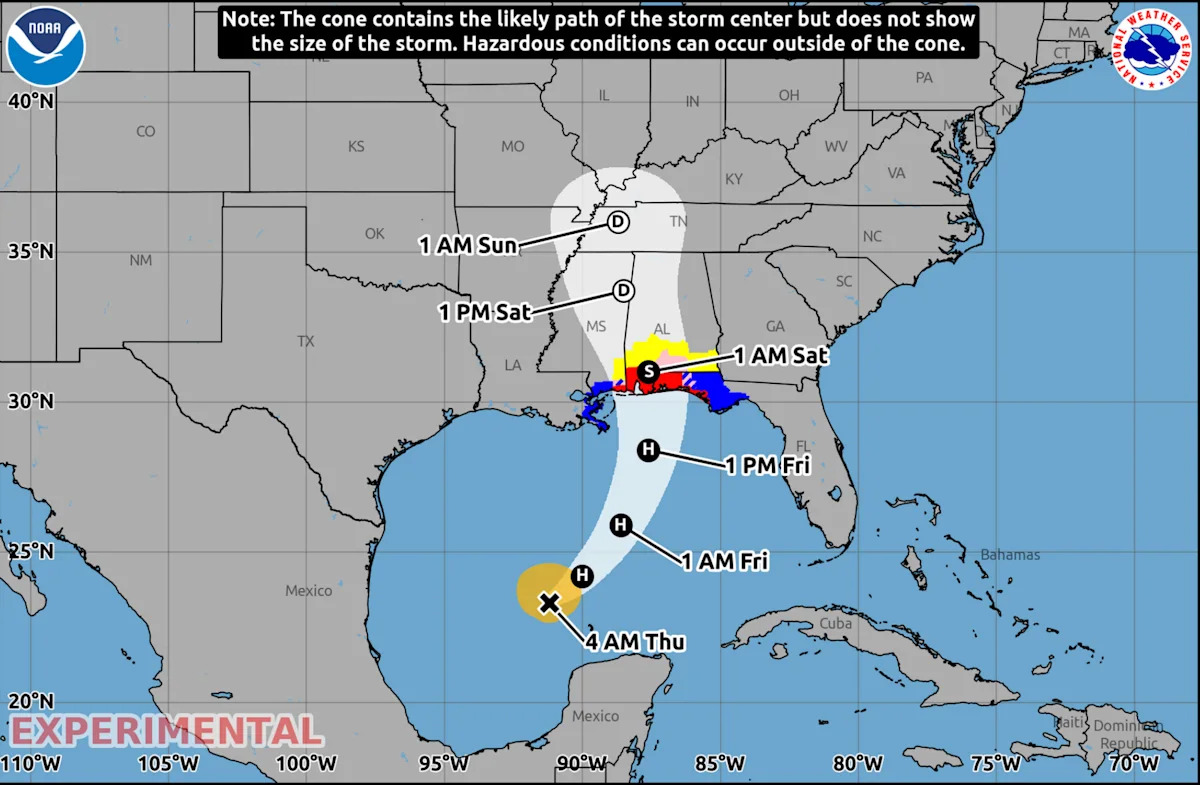
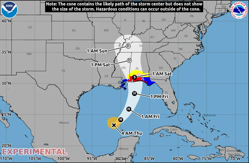
Hurricane Isaias, the first hurricane of the Atlantic season, is expected to strengthen when it approaches the northern Gulf Coast on Friday, prompting mandatory evacuations, school closures in parts of Florida and the threat of a life-threatening storm surge, according to the National Hurricane Center.

Isaias is forecast to make landfall within the warning area late Friday or early Saturday, according to the National Weather Service, which warned of damaging hurricane-force winds. The National Hurricane Center (NHC) said Isaias was expected to remain a strong hurricane throughout this period.

It is unclear exactly where Isaias might make landfall. Current models show the center of the storm coming onshore anywhere from eastern Mississippi to the western tip of the Florida Panhandle.

The NWS said residents in portions of the Florida Panhandle, southern Alabama, some parts of Mississippi, including the south, should "prepare for the possibility of long-duration power outages."

The governors of Florida and Alabama declared states of emergency for dozens of counties. Okaloosa County in Florida announced mandatory evacuations for some coastal areas. "Residents should take this storm seriously and evacuate," the county government said in a news release.

"Floridians should take this time to get disaster plans in place and ensure their hurricane supply kit is stocked," Florida Gov. Ron DeSantis said. He urged communities in a post on X to "make sure to execute your hurricane plan."

Emergency management officials in Mississippi and Alabama are urging residents to begin preparing for the storm. The University of Alabama said that it is closely monitoring Isaias, but that the Crimson Tide's home football game against Georgia in Tuscaloosa, Ala., scheduled for 7:30 p.m. ET on Saturday, will go on as scheduled. President Trump is scheduled to attend the game.

Alabama Gulf Shores resident Maranie Adams gathered water and other supplies as her family moved belongings, including a hot tub motor, to higher ground. Her family planned to ride out the storm at home, roughly a half-mile from shore, sheltering indoors alongside their flock of chickens.

"We're having to get crates to bring them into the house so they don't blow away," Adams told AP. "It's going to be noisy."

Oil and gas producers shut down around 25% of current oil production and 16% of current natural gas production as of Wednesday in response to the hurricane.

Is the storm headed your way? Follow it in real time on the new Yahoo Weather app.

The NHC said storm surges of up to 7 feet were possible in parts of Florida, and 5 feet in Mississippi, if the peak surge occurs at the time of high tide. Some areas could see up to 10 inches of rain.

Before Isaias, the Atlantic hurricane season, which runs from June to November, had not gone this late in the year without a hurricane since 1905, according to the Associated Press. A typical Atlantic hurricane season produces 14 named storms, of which seven become hurricanes. This year, there have been nine named storms, and no hurricanes.

According to the hurricane center's latest advisory, as of 4 a.m. CT on Thursday:

Isaias was located about 420 miles south-southwest of the mouth of the Mississippi River

It had maximum sustained winds of 80 mph

It was moving east-northeast at 9 mph

Hurricane-force winds extended up to 15 miles from the center, and tropical-storm-force winds up to 90 miles

Hurricane, tropical storm and storm surge watches have been issued across portions of the northern Gulf Coast.

A hurricane warning is in effect for:

Ocean Springs, Miss., to the Bay/Gulf County Line, Fla.

A tropical storm warning is in effect for:

The Jefferson/Plaquemines Parish line in Louisiana to west of Ocean Springs, Miss.

East of the Bay/Gulf County Line to the Aucilla River, Fla.

A storm surge warning is in effect for:

The mouth of the Mississippi River to the Steinhatchee River, Fla.

A storm surge watch is in effect for:

The Steinhatchee River to Yankeetown, Fla.

The NHC said the water could reach the following heights above ground somewhere in these areas if the peak surge coincides with high tide:

Ocean Springs, Miss., to Indian Pass, Fla.: 5 to 7 feet

Mobile Bay: 5 to 7 feet

Indian Pass to the Steinhatchee River, Fla.: 4 to 6 feet

Mouth of the Mississippi River to Ocean Springs: 3 to 5 feet

Steinhatchee River to Yankeetown, Fla.: 2 to 4 feet

Lake Pontchartrain: 1 to 3 feet

A hurricane warning means hurricane conditions (sustained winds of 74 mph or higher) are expected somewhere within the warning area, per the NHC. It is typically issued 36 hours before the anticipated arrival of tropical-storm-force winds.

A tropical storm warning means tropical storm conditions (sustained winds of 39 to 73 mph) are expected somewhere within the warning area within 36 hours.

A storm surge warning means there is a danger of "life-threatening inundation from rising water moving inland" — meaning flooding of normally dry land by seawater pushed ashore by the storm — during the next 36 hours. A storm surge watch means there is a possibility of inundation within 48 hours.

An unusually strong El Niño has contributed to the relatively quiet Atlantic hurricane season by increasing wind shear — rapid changes in wind speed or direction with height — which can disrupt tropical storms and make it harder for them to strengthen into hurricanes.

By contrast, El Niño conditions have contributed to an unusually busy Pacific hurricane season. There have been 21 named storms and 10 hurricanes, both above historical averages. Last month's Hurricane Polo became the third of the season to reach Category 5 intensity.

Lindsey Long, a meteorologist with the U.S. National Oceanic and Atmospheric Administration's Climate Prediction Center, said the wind shear had weakened in the area. "It only takes one storm for a lot of possible destruction. So you don't want to put your guard down," Long told the Associated Press.
Comments
You must be logged in to comment.