bbc Press
UK weather: Temperatures to fall but relief from the heat may be short-lived
Images

1 / 20
2 / 20
3 / 20
4 / 20

5 / 20

6 / 20

7 / 20

8 / 20

9 / 20

10 / 20

11 / 20

12 / 20
13 / 20
14 / 20

15 / 20

16 / 20

17 / 20
18 / 20

19 / 20

20 / 20
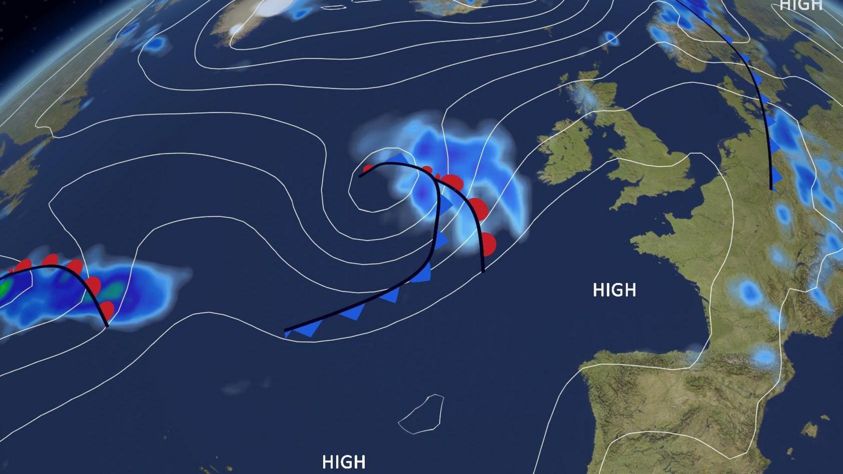
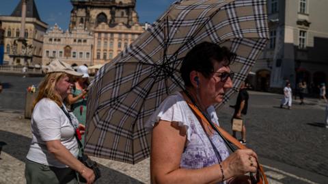
The UK is set for cooler weather this week after a spell of record-breaking heat, but the reprieve may not last long.

New June heat records were set on three consecutive days last week, ending with 37.3C at Santon Downham in Suffolk, smashing the previous June record of 35.6C set in 1976.

This week, with weather coming in from the Atlantic on south-westerly winds, temperatures will fall and areas of low pressure will bring some rain.

By the weekend, however, high pressure may become more dominant with another chance of a heatwave on the way.

The area of high pressure causing last week's blistering heat has moved into eastern Europe, allowing temperatures to fall in the west.

South-westerly winds from the Atlantic have arrived in the UK, dropping temperatures and lowering the humidity.

On Monday, most places will be dry with sunny spells. Temperatures will be highest in the Midlands and eastern England - a more comfortable 24 or 25C.

On Tuesday, an area of low pressure is set to bring showers or longer spells of rain, mainly to northern and western areas.

Some of the rain could be heavy and thundery.

The pressure chart for Monday shows the "Azores high" building in from the south-west and low pressure systems in the Atlantic

A second area of low pressure will then arrive from the Atlantic later on Wednesday. As it steers further north, the rain and stronger winds are more likely in Northern Ireland than Scotland.

The low pressure will move away to Scandinavia on Wednesday night, and Thursday should be dry after morning blustery showers in Scotland die out.

Throughout the week, pressure will be higher in the south with south-eastern parts of England potentially missing out on the rain.

It could be a completely dry first week at Wimbledon.

The highest temperatures of this week will also be in south-east England, reaching around 25 or 26C. Though this is above average for this time of year, it is a far cry from the heat and humidity of last week.

An area of high pressure extending from the Azores at the end of the week could end up being parked over the UK and parts of western Europe from the weekend and into early next week.

It is not out of the question that this could turn into another heat dome with rapidly rising temperatures and more sunshine.

While it is still a long way off, it is possible that the heatwave threshold will once again be triggered in south-eastern parts of the UK in early July.

Coasts tend to be cooler than inland areas during a heatwave

Some weather models are suggesting a similar weather pattern to the record-breaking heatwave in June, with more extreme forecast temperatures of 35C.

What we do know is that heatwaves in the UK are become more intense and frequent due to human-induced climate change.

The long-term forecast also suggests significant bursts of heat are still likely in July and August.

Keep an eye on the forecast for your local area here.

How did you cope in the recent heatwave? How did you adapt your day-to-day life?

Will the weather stay dry for week one of Wimbledon?

Full Strawberry Moon set to light up night sky

Are we in for a summer of serial heatwaves?
Comments
You must be logged in to comment.