aljazeera Press
Is the Great Nicobar Island India’s Hormuz-like chokepoint against China?
Images
1 / 9

2 / 9

3 / 9

4 / 9

5 / 9

6 / 9

7 / 9

8 / 9

9 / 9
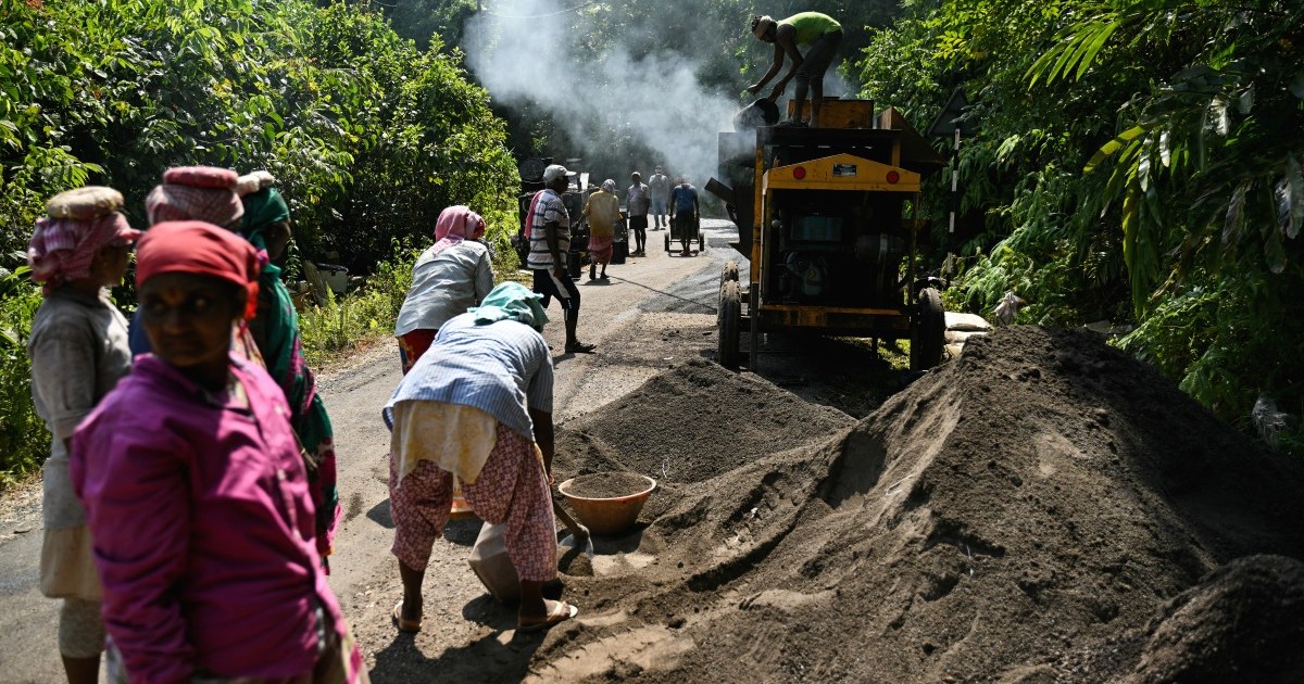
Far away from the mainland, the Indian government is pumping billions of dollars into a controversial development project that could spell the end of Great Nicobar Island.

Save

Share

New Delhi, India — The southernmost point of India, the Great Nicobar Island, is closer to the coasts of Thailand, Malaysia and Indonesia than it is to the Indian mainland.

No Indian prime minister has visited the island, which is the size of Hong Kong, since Indira Gandhi in 1984. India does not even conduct a full census on the island, relying on estimates of its population; the latest guess is that fewer than 10,000 people live there.

Yet the island is now in the eye of a political storm over an $11bn project planned by Prime Minister Narendra Modi’s government to turn Great Nicobar into a major strategic and economic outpost in the Indian Ocean.

The Modi government has greenlit plans to build a transhipment port, a civilian-military airport, a power plant, tourism infrastructure and a township for 350,000 people on the island.

In its blueprint, the government highlighted the economics of maritime trade as the justification for the project.

But in the face of growing criticism from global environmental watchdogs and opposition leaders in New Delhi, the Indian government has shifted its narrative to position the plan as central to the country’s strategic goals in its neighbourhood.

And the United States-Iran struggle over the Strait of Hormuz has given that vision a boost, serving as a reminder of the importance of a perch that can serve military and economic aims over a strategic waterway — in this case, the Strait of Malacca, through which a third of global trade and seaborne oil flows.

“This island has a strategic value because it is sitting right at the mouth of Malacca [strait],” Shekhar Sinha, a former vice chief of the Indian Navy, told Al Jazeera. “And if it is [developed as] a commercial setup,” he added, no one would be able to object.

Stretching into the southeastern end of the Bay of Bengal, the Great Nicobar Island sits nearly 1,600km (994 miles) from mainland India, near the western approaches to the Strait of Malacca. It lies adjacent to East-West shipping lanes that carry trade and supplies between the Gulf, Europe and East Asia, including China, Japan and South Korea.

It is only 2.8km (1.7-mile) wide at its narrowest at the Phillip Channel near Singapore, yet it is the principal body of water connecting the Middle East to Southeast Asia.

And while the world’s trade depends on this strait, it is especially critical for China, which relies on the route for 80 percent of its crude oil imports and two-thirds of its trade.

That geography makes Great Nicobar a potentially valuable sentry for India, watching over the Strait of Malacca.

“It is a great place to monitor all the traffic, coming in and out of the strait,” Sinha said. “It would give India an edge in maritime domain awareness,” referring to New Delhi’s ability to track and monitor activity at sea.

The Modi government has in recent weeks increasingly acknowledged the strategic value of the island.

The Great Nicobar project “is a strategic project which aims to strengthen India’s presence in the Andaman Sea and Southeast Asia,” the government noted in a press release in May. “The project is designed to enhance India’s national security, strategic and defence presence, strengthen the islands’ economic position, and accelerate holistic development in the region.”

Yet that is not how the project was envisaged, at least in the government’s official vision. Rather, it was pitched to rival the deepwater port-led economies of Singapore, Sri Lanka’s Colombo and even Hong Kong.

The government’s plans quickly faced stiff resistance, including from the inhabitants of the island, who have since refused to give up their lands to make way for the construction and have filed cases against the government’s plans in multiple courts.

Last in the chain of the Nicobar Islands, the Great Nicobar is home to a few hundred Shompens, a seminomadic hunter-gatherer tribe living in dense forest interiors, and a few thousand fishing-dependent Nicobarese who survive on the elegant ecosystem.

The Indigenous communities maintain distance from the outside world and the settler population on the island, which is spread over about 1,000sq km (400sq miles).

The government’s project is currently planned on 166.1sq km of land, roughly 16 percent of the entire island. Half of this land overlaps with tribal reserve areas, which the Shompens inhabit.

In February 2024, 39 genocide experts wrote to Indian President Droupadi Murmu, warning that the project would be “a death sentence for the Shompen”, tantamount to the international crime of genocide.

India’s environment minister informed Parliament in 2023 that nearly 964,000 trees would be felled for the project. The development would also displace the native fishing-dependent Nicobarese community and make way for the settlement of 350,000 people over the next three decades.

If that happens, it would mean a 4,000 percent population increase on the island.

The ancestral lands of the Nicobarese community have been marked for a tourism zone under the project, even as their protests against it continue.

The Indian government has maintained that the criticism is unfounded and that the project will be a model for a holistic approach towards island development.

But activists warn the project would severely disrupt Great Nicobar’s fragile ecology through large-scale deforestation, coastal alteration and infrastructure construction in one of India’s most biodiverse island ecosystems.

The island also falls in seismic zone 5, the highest earthquake-risk category, making large construction projects on Great Nicobar particularly vulnerable.

Rahul Gandhi, India’s leader of the opposition, visited the island a month ago and met local activists and affected people. Writing on his X handle later, the Congress party leader said: “The government calls what it is doing here a ‘Project’ … It is communities that have been ignored while their homes have been snatched away. This is destruction dressed in development’s language.”

Gandhi claimed that the Great Nicobar project was “one of the biggest scams and gravest crimes against this country’s natural and tribal heritage in our lifetime”.

He also visited the Indira Point Lighthouse, the southernmost tip of Indian territory, named after his grandmother and former Prime Minister Indira Gandhi.

That lighthouse, once surrounded by lush trees, stands partially submerged in the water.

The devastating 2004 tsunami sank the land near the southern tip of Great Nicobar by about 4.25 metres (14 feet), flooding parts of the coastline around Indira Point.

“This project is very colonial,” said Manish Chandi, former member of the research advisory board of the government-managed Andaman and Nicobar Tribal Research and Training Institute.

Chandi, who has spent more than two decades studying the islands and their people, said he was convinced that the main aim of the project was to develop Great Nicobar as a commercial outpost. The pushback, he said, is what made the government pitch the initiative as one tied to national security. “It suits the [Modi government’s nationalist] narrative,” Chandi told Al Jazeera.

Still, while the justification for the project has shifted to include strategic goals, the world has also transformed since the government’s top planning body commissioned a master plan for the Great Nicobar development initiative in 2020.

Some analysts argued that these shifts require India to stay nimble.

“The nature of rapidly changing geopolitics is becoming more challenging,” said Harsh Pant, vice president of Observer Research Foundation, a New Delhi-based think tank. “It is natural for India to relook at its own geography to find leverage to its strategic advantages.”

The Indian armed forces’ tri-service command is based in Sri Vijaya Puram, formerly known as Port Blair, the capital of the chain of islands, about 500km (310 miles) from Great Nicobar.

Building Great Nicobar up would “enhance the command, make it more formidable, and use this geography for keeping a tab on what is happening in the wider Indo-Pacific”, said Pant.

With Iran using its control of the Strait of Hormuz as leverage in diplomacy, sections of Indian strategic thinkers have voiced the idea that New Delhi could — in the event of a future conflict with rival China — use the geography of Great Nicobar to try to choke the Strait of Malacca.

Sinha, the former naval officer, laughed off such suggestions.

“The Hormuz Strait belongs to Iran and Oman. Likewise, the Malacca Strait belongs to Indonesia,” Sinha said. “The passage goes through Indonesia. And the peace in these waters is equally important to India’s economy in the first place.”

The former naval officer argued that setting up a naval blockade is simple, but maintaining it is difficult. “Look at the US: if that big a navy cannot keep [an] airtight naval blockade of a narrow waterway, how can an Indian navy block the vast Indian Ocean?” Sinha wondered.

Still, he said, the island’s development could prove an asset for India strategically.

“Advance position in Malacca would make the Indian Ocean more transparent for India,” said Sinha.

Chandi, though, is convinced that the price that Great Nicobar — and India — will need to pay for the project is not worth it.

“The focus is not on defence expansion; it is a commercial proposal with dubious outcomes and destructive scope,” Chandi told Al Jazeera. “[It] will be a liability for India and for its defence.”
Comments
You must be logged in to comment.