yahoo Press
MN weather: Twin Cities metro at risk for strong storms Monday night
Images
1 / 9

2 / 9

3 / 9

4 / 9

5 / 9
6 / 9

7 / 9

8 / 9

9 / 9
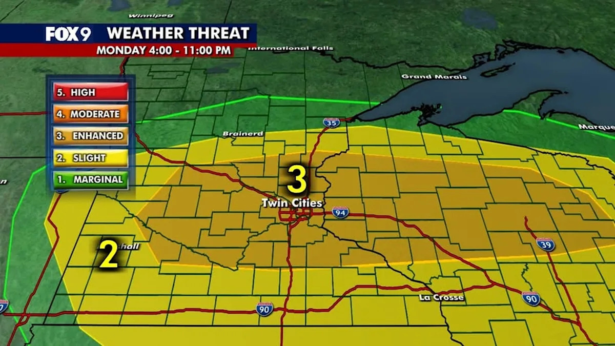
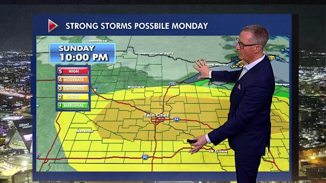
The Brief

A warm and windy Sunday set up the potential for strong storms on Monday.

The Twin Cities and several parts of Minnesota are at risk for strong storms Monday afternoon and evening. Tornadoes are possible, but the greater threats are large hail and strong winds.

It's the start of an unsettled week with several chances for rain.

MINNEAPOLIS (FOX 9) - It’s the middle of April, but Sunday felt more like summer with high temperatures around 80 and strong winds.

Could we get an early taste of severe weather on Monday?

What we know

FOX 9 Meteorologist Ian Leonard says strong storms are possible late Monday afternoon and into the evening, an area that includes the Twin Cities metro. On the back side of that, we stay generally unsettled for most of the week.

The Twin Cities metro, central and western Minnesota and western Wisconsin are at an Level 3 Risk (Enhanced) for severe weather from 4 p.m. to 11 p.m. Monday. Areas north and west of the metro, and far southern Minnesota are expected to be at a Level 2 Risk (Slight) for severe weather.

What we don't know

Tornadoes are a possibility east of the Twin Cities metro, but the greatest threats are very large hail and damaging winds.

Timeline

Once the storms clear Monday night, an unsettled week continues with chances for rain Tuesday, Wednesday and Thursday. There’s another chance for rain Saturday as temperatures fall into the high 40s before the sun returns on Sunday.
Comments
You must be logged in to comment.