bbc Press
World's longest coastal path opens in England to the public
Images

1 / 10

2 / 10
3 / 10

4 / 10
5 / 10
6 / 10
7 / 10
8 / 10
9 / 10

10 / 10
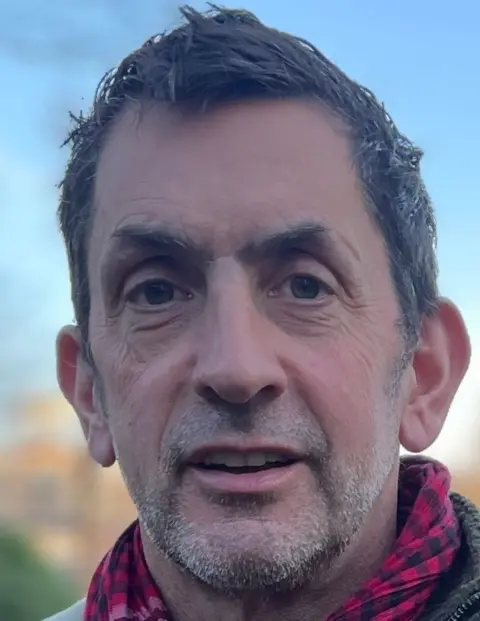
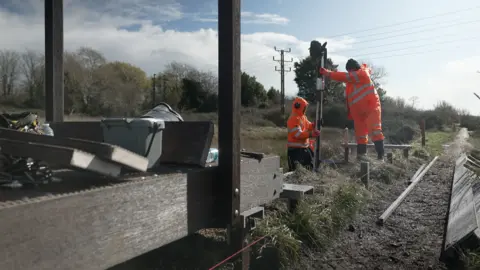
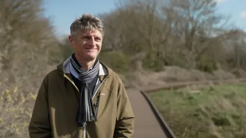
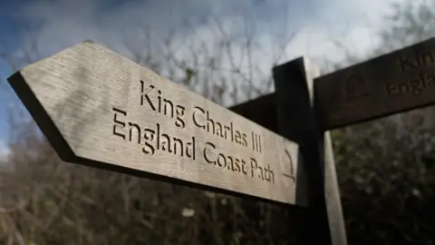
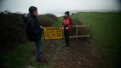
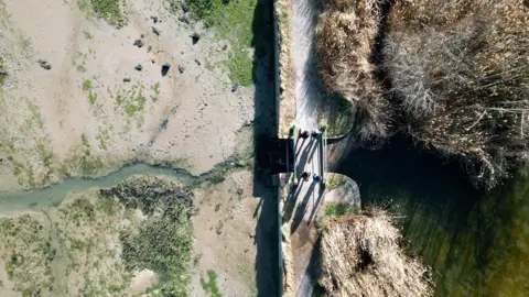
A new footpath stretching around the entire coast of England is being officially inaugurated later.

At 2,689 miles long, it is the longest managed coastal walking route in the world, according to Natural England, the government body which created it.

Its name is quite a trek too - King Charles III England Coast Path - but for the first time it creates a continuous trail, allowing walkers to explore England's shoreline step by step.

Along the way, it passes through some of the country's most beautiful and varied landscapes, from salt marshes and sandy beaches to cliffs, dunes and historic coastal towns.

Among the highlights is the iconic chalk downland of the Seven Sisters in East Sussex, which also forms part of a newly designated National Nature Reserve being announced by Natural England.

Much of the new coastal route already existed, but more than 1,000 miles of new paths have been created, and many other sections upgraded. Paths have been resurfaced, stiles removed, boardwalks built and bridges installed.

The project was initiated during Gordon Brown's government, and it has taken 18 years and seven prime ministers to get to this stage.

About 80% of the route is now open and most of the rest of the path is due to be completed by the end of the year.

"It is brilliant - the best thing I'll do in my working life," says Neil Constable, who led the project for Natural England.

For him, the length of the path isn't really the point.  What makes it so special, he says, is that you can walk to the coast anywhere in England, turn left or right, and walk beside the sea for as long as you like.

Creating the route required new legislation – the Marine and Coastal Access Act, passed in 2009 – as well as years of careful planning and extensive work along the shoreline to establish a clear and continuous footpath.

Natural England says that in many places, new rights of access have opened land that was previously off-limits to the public - including beaches, dunes and cliff-tops between the path and the sea.

It says accessibility for those with reduced mobility has been improved so that more people can enjoy sections of the trail.

Gaps in the existing network of footpaths have been filled with a focus on bringing the route closer to the water and connecting stretches of coastline that had never been joined by a single walking trail.

But in a few places, walkers must briefly leave the trail. In north-west England, for example, a ferry across the Mersey is needed to follow the route.

One stretch in south Devon is particularly challenging. At the River Erme, there is no bridge or ferry, and the land further upstream is privately owned and inaccessible. Walkers must therefore roll up their trousers and wade across the river within an hour either side of low tide.

"It's all part of the experience," says Constable.

The path has been designed with the heavier rains and rising seas that climate change is expected to bring in mind.

For the first time in English law there is provision for the route to be moved inland – "rolled back", Natural England calls it - if the coastline erodes or shifts.

This allows the trail to adapt to the changing shoreline and aims to ensure that the coastal walk remains continuous and practical for generations to come.

Recent weeks have shown how dynamic the route can be. A large section of the path on the cliffs outside Charmouth in Dorset was lost in early February after heavy winter rains caused a landslip.

"The path was closed and a diversion was put in place," explains Lorna Sherriff, who heads up the team that manages the South West Coast Path – the longest and hilliest section of the new trail.

The diversion added an extra mile and a half and - worse still - took walkers along roads. Sherriff says her team quickly arranged a 15-metre rollback with the landowner, and within weeks the path was open again.

"Without this rollback provision in place that would have taken us months," she says.

The Ramblers charity has been campaigning for greater access to England's coastline since the end of World War II. Jack Cornish, director of England for the Ramblers, describes the new path as "transformational".

"It creates a band of access land from the trail to the high water mark, so that means you can leave the trail to go and roam the beaches," Cornish says. "You can picnic - and on an island nation you can really enjoy our coast for the first time."

The route also raises the possibility of a continuous coastal walk around the entire island of Britain.

The new English coast path links with the Wales Coast Path - an 870-mile route encircling the Welsh coastline. It was completed in 2012 and was the first path in the world to follow an entire national coastline.

There is no single official coastal trail in Scotland, though much of the shoreline is accessible thanks to Scotland's "right to roam" law passed more than 20 years ago.  Estimates of its mainland coastline vary depending on how it is measured, but it is often put at around 5,500 miles.

Taken together, a continuous coastal walk around Britain would therefore total some 9,000 miles. At an average of 15 miles a day, it would take almost two years to complete, assuming no rest days.

If you want to walk some – maybe even all – of the King Charles III England Coast Path, you can access route maps at the National Trails website.

Sign up for our Future Earth newsletter to keep up with the latest climate and environment stories with the BBC's Justin Rowlatt. Outside the UK? Sign up to our international newsletter here.
Comments
You must be logged in to comment.