Press
UK weather: Warmest day of the year so far as temperatures hit 18C
Images
1 / 19

2 / 19
3 / 19
4 / 19
5 / 19
6 / 19
7 / 19
8 / 19
9 / 19
10 / 19

11 / 19
12 / 19
13 / 19

14 / 19

15 / 19

16 / 19

17 / 19

18 / 19

19 / 19
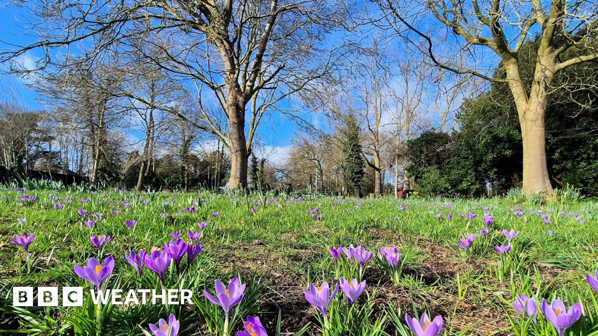
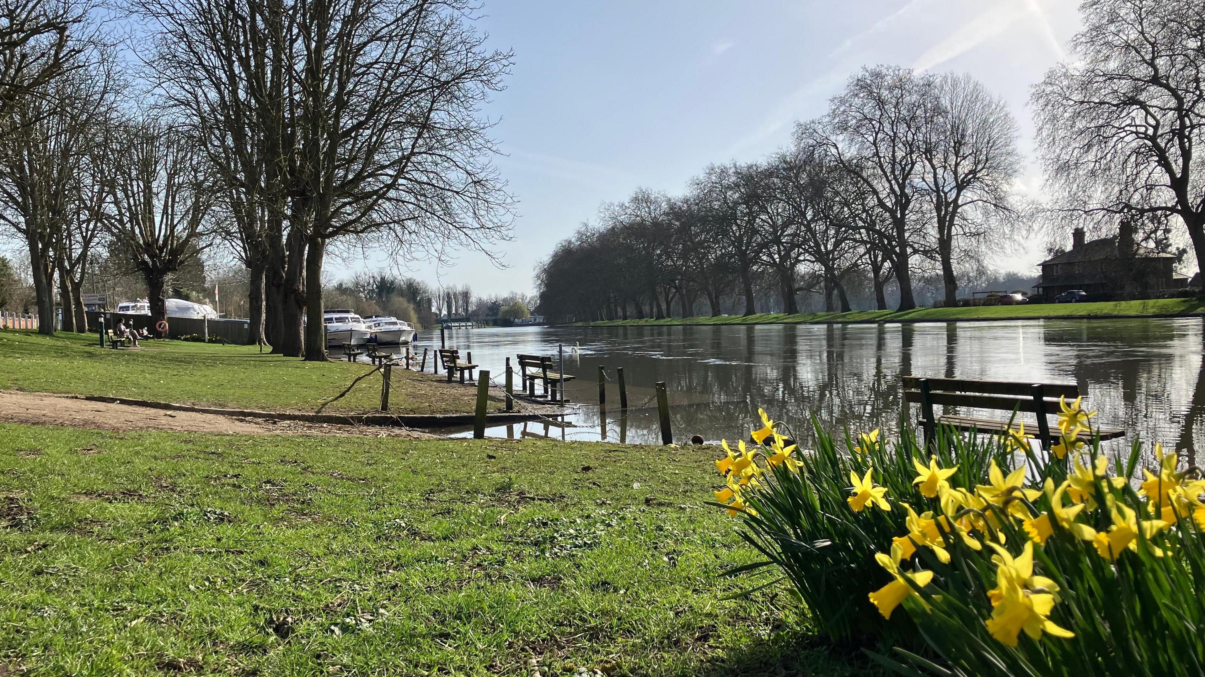
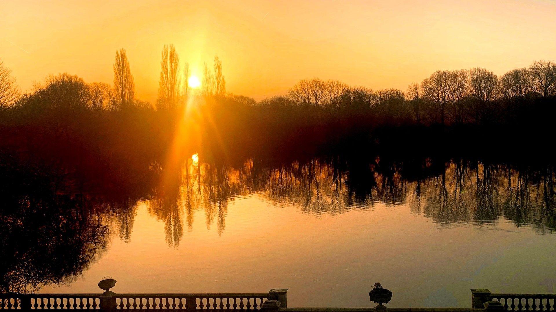
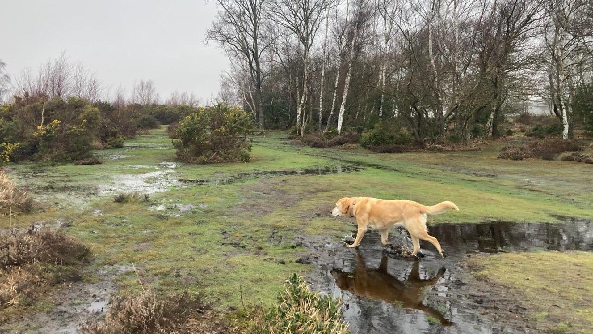
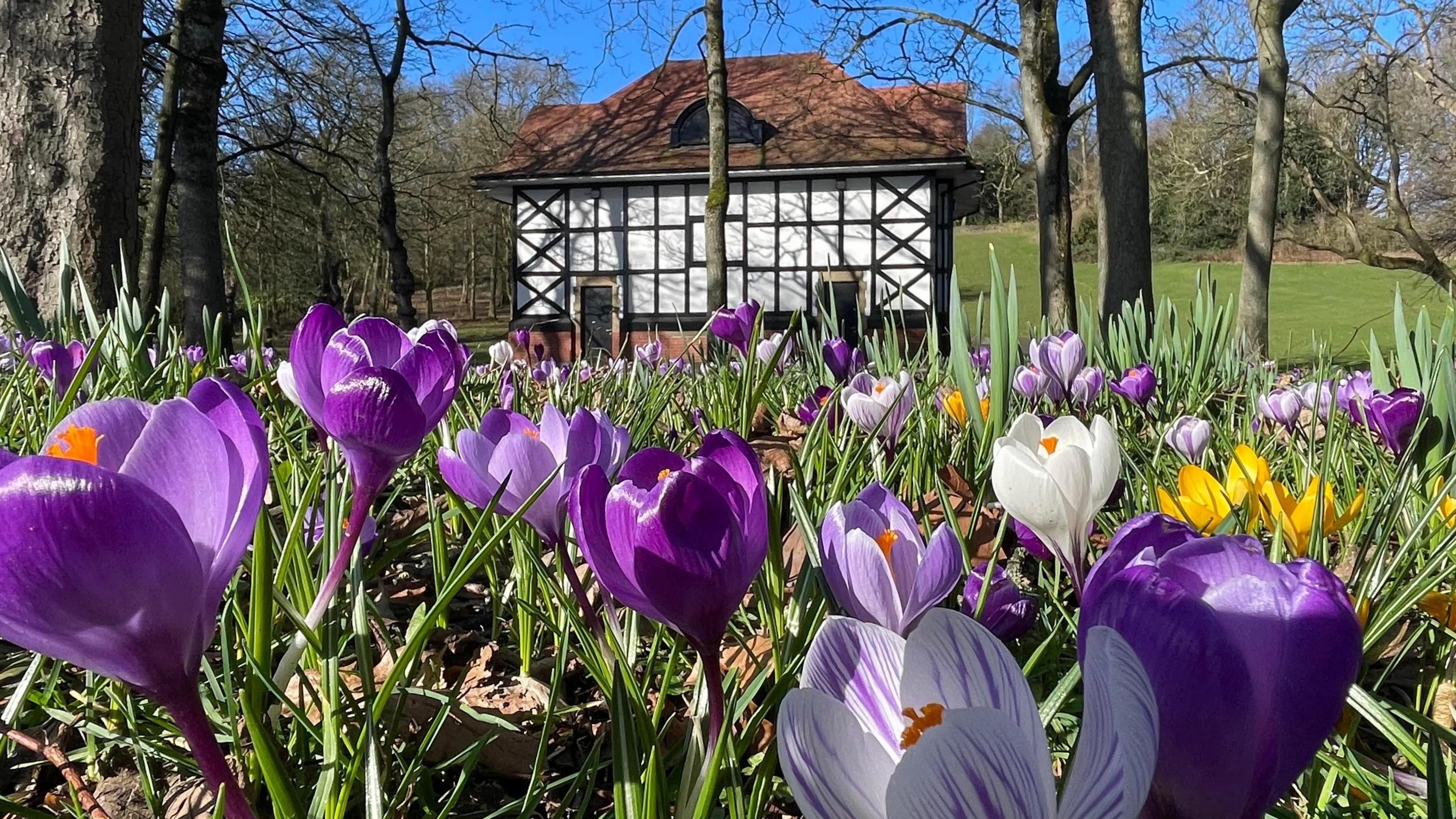
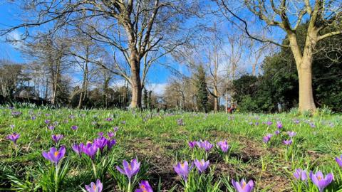
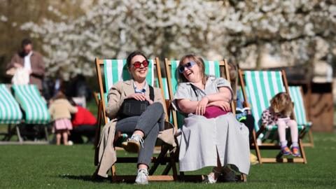
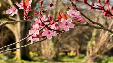
A feel of spring in the air for some on Wednesday

Temperatures have climbed to their highest so far this year and will continue to rise this afternoon with the spring-like sunshine for some.

At lunchtime, parts of East Anglia and south-east England have recorded temperatures in excess of 17C (63F).

While much of central, eastern and south-east England are enjoying the sunshine and warmth, cloud and rain at times continues further north and west.

A change to a milder southerly wind has given temperatures a boost, as well as the possibility of a vivid sunset as it transports a plume of Saharan dust towards the UK.

Spring looks and feels like it has 'sprung' in Berkshire on Wednesday lunchtime as temperatures rise to the high teens

The mercury could rise a little further still on Wednesday in south-east England with the likelihood of us seeing 18C (64F) in the best of the sunshine.

In the north and west of the UK there will be more cloud and some rain, but temperatures even here will still be above average.

For Wales, Scotland and Northern Ireland, temperatures aren't likely to exceed those seen in recent days of 15.2C, 13.7C and 13.4C respectively.

The last time the temperature reached 18C was 13 November 2025, and the record for February is 21.2C (70.2F) on 26 February 2019 at Kew Gardens.

Wednesday is likely to be the peak of the warmth this week, with temperatures back to near average by the last day on February and even a possible frost for many on Friday night.

When does spring start?

Saharan dust in the atmosphere can make sunrises and sunsets look especially dramatic and vibrant

The warmer southerly wind is also helping draw up a plume of Saharan dust to the UK which could bring dramatic, fiery sunrises and sunsets over the coming days.

The dust from the Sahara has been picked up high into the atmosphere and is carried thousands of miles before gradually filtering down toward the surface.

As the fine particles scatter sunlight, they can enhance reds and oranges at dawn and dusk when conditions are right.

If the dust also combines with spells of rain, it can lead to what is often referred to as "blood rain", leaving behind a thin, dirty residue on cars, windows and outdoor surfaces.

While it can appear dramatic, this is a relatively common and entirely natural seasonal event in the UK, according to the Met Office.

Episodes of Saharan dust transport occur several times a year, most often in late winter and spring, when southerly winds draw warm air northwards from north Africa towards the UK.

Look out for some particularly intense colours at dawn and dusk later on Wednesday, as well as during Thursday and Friday.

Dust concentrations are expected to be highest over southern England.

The ground is still saturated in some places after weeks of rain

Generally it hasn't been as wet for the last week or so. However, areas of low pressure and spells of rain will continue to be driven over the UK at times as we head into spring.

The wettest weather is expected to be over western hills, particularly in western Scotland. There won't be much rainfall in eastern parts of England - a pattern that is more typical for this time of year.

Given the saturated ground in some parts, the risk of flooding will remain a concern well in to March.

What are your worst weather experiences of this winter? Let us know.

Spring is 'fastest-warming' season in the UK
Comments
You must be logged in to comment.